LPA Enters PAR 2025: PAGASA Issues Weather Advisory, Urges Public Preparedness
MANILA, Philippines — June 6, 2025
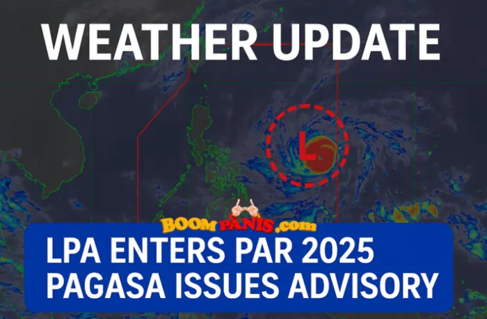
A low-pressure area (LPA) has officially entered the Philippine Area of Responsibility (PAR), according to the Philippine Atmospheric, Geophysical and Astronomical Services Administration (PAGASA). This weather development, now being monitored under the label LPA enters PAR 2025, is the first of its kind this year.
PAGASA warns that while this LPA is not yet classified as a storm, it could bring moderate to heavy rainfall, possibly leading to localized flooding and landslides in some areas of the country.
What Is an LPA?
A Low-Pressure Area (LPA) is a weather system characterized by lower atmospheric pressure than surrounding regions. It typically causes cloudy skies, scattered rain showers, and isolated thunderstorms.
Although not yet a tropical cyclone, PAGASA notes that an LPA can develop into a tropical depression if environmental factors—such as warm sea surface temperatures and wind patterns—are favorable.
“Tropical weather is unpredictable. Today’s low-pressure area could be tomorrow’s storm,” a PAGASA spokesperson emphasized.
Areas Likely to Be Affected
As the LPA enters PAR 2025, PAGASA has identified regions with increased rainfall risk in the coming days. These include:
- Eastern Visayas
- Bicol Region
- Northern and Central Mindanao
Communities in flood-prone or mountainous areas are urged to prepare for potential flash floods and landslides. Residents are advised to remain alert and coordinate with local authorities for real-time updates.
PAGASA’s Official Bulletin
In its June 6, 2025 advisory, PAGASA reported that the LPA was spotted 250 kilometers east of Eastern Samar as of 10:00 AM. The system may enhance rainfall over Visayas and nearby regions.
“The LPA may enhance rainfall over parts of the Visayas and nearby regions. Further updates will be issued as necessary,” PAGASA stated.
The public is reminded to follow only official sources for weather updates to avoid misinformation.
Safety Precautions to Take Now
In light of the current weather system, PAGASA encourages the public to observe the following precautions:
- Stay informed via the PAGASA website and verified social media channels.
- Prepare emergency kits with food, water, flashlights, batteries, and essential medicines.
- Charge phones and power banks in case of extended power interruptions.
- Avoid non-essential travel during periods of heavy rain.
- Coordinate with DRRMOs for localized advisories and emergency support.
“Preparedness saves lives. Staying informed and ready is your best defense against unpredictable weather,” PAGASA reminded the public.
Will the LPA Intensify?
Currently, there are no signs that the LPA has strengthened into a tropical cyclone. However, PAGASA continues to monitor its trajectory. Experts say the system’s development will depend on multiple atmospheric conditions.
Although the system may dissipate, there remains a chance it could intensify into a tropical depression. Thus, vigilance is strongly advised.
When Is the Next Update?
The next official weather bulletin on the LPA enters PAR 2025 will be issued by PAGASA at 5:00 PM today, June 6, 2025. This update will include the latest information on the LPA’s location, intensity, movement, and potential development into a tropical depression.
PAGASA may also revise rainfall warnings or expand coverage areas based on real-time satellite and Doppler radar data. Residents are urged to stay tuned to these advisories, especially if they are located in low-lying, coastal, or mountainous areas prone to flooding and landslides.
Timely access to accurate information can help families make life-saving decisions, including early evacuation or travel postponement.
To avoid misinformation, PAGASA reminds the public to get updates only from trusted and official sources, such as:
- The PAGASA website
- Verified Facebook and Twitter pages of PAGASA
- Local Disaster Risk Reduction and Management Offices (DRRMOs)
- Credible radio and television news broadcasts
Remaining informed through these channels ensures accurate, real-time guidance during developing weather conditions.
Where to Get Reliable Updates
To avoid misinformation, PAGASA recommends the following trusted sources:
- PAGASA Official Website
- PAGASA’s Verified Facebook and Twitter Pages
- Local Disaster Risk Reduction and Management Offices (DRRMOs)
- Trusted radio and television news outlets
Final Thoughts
The report that an LPA enters PAR 2025 should not be dismissed. While it may not yet be a storm, low-pressure areas can still cause serious impacts, including heavy rainfall, flooding, and landslides, especially in vulnerable communities.
Filipinos are strongly encouraged to stay alert, follow only official PAGASA advisories, and avoid misinformation spreading on social media. Preparedness and awareness are your best defenses against unpredictable tropical weather.
Disclaimer
This article is intended for informational purposes only. For the most accurate and up-to-date weather information, always refer to PAGASA, your local disaster risk reduction offices, or authorized government agencies.
Some links in this content may be affiliate links, which come at no additional cost to users and do not influence the accuracy or neutrality of the information provided
📚 References
- PAGASA – Philippine Atmospheric, Geophysical and Astronomical Services Administration
- NDRRMC – National Disaster Risk Reduction and Management Council

Bianca Marie Reyes, aka Tita BoomBi, is a 30-year-old Filipina content creator who turns everyday chika into real talk and real-time news. Known for her witty takes and no-fake-news style, she breaks down viral stories, headlines, and public updates into fun, bite-sized content for the digital Filipino. She’s your online tita, always tuned in and always telling it like it is. With a mix of humour and honesty, she keeps things relevant, relatable, and 100% not fake.